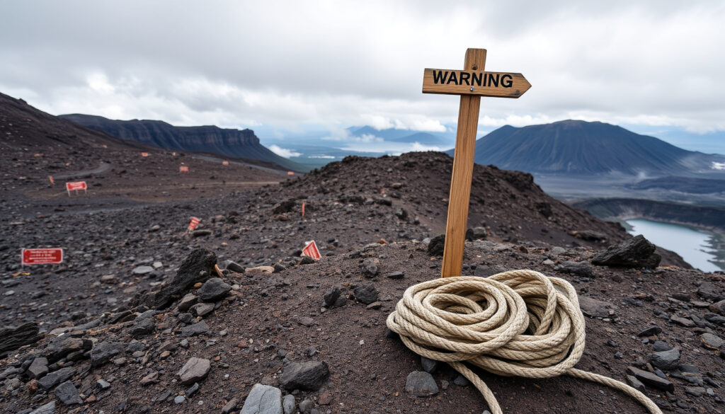
Tongariro Expeditions Safety Breach: What Hikers Need to Know
Picture this: you have booked the shuttle, checked a weather app, and still find yourself standing on a volcano with the sky closing in — exactly how a tramper ended up in a coroner’s report after walking the Tongariro Alpine Crossing in April 2019. The official warnings from New Zealand Department of Conservation (official track manager) explain why, the rahui explains what changed, and the shuttle logistics explain how to do the crossing safely.
Track length: 19.4 km DOC (track manager) · Elevation gain: 1200 m DOC (track manager) · Average hiking time: 6–9 hours Tongariro Expeditions (shuttle operator) · Reported fatality: April 2019 Tongariro Expeditions (shuttle operator) · Coroner report: June 2021 Tongariro Expeditions (shuttle operator) · Track status: Open after 2023 reopening DOC (track manager)
Quick snapshot
- The track is an alpine route with high fitness demands, geothermal hazards, loose rock and fast-changing weather (New Zealand Department of Conservation (official track manager)).
- Summer conditions can still bring cold, wind, heavy rain and poor visibility (Tourism New Zealand (national tourism authority)).
- The shuttle season typically runs from about October until May or June (Tongariro Expeditions (shuttle operator)).
- Public reporting does not consolidate the exact number of rescues on the crossing each year.
- The long-term impact of the rahui on permit systems and access rules is still settling.
- How many hikers attempt the crossing without proper gear each year is not tracked.
- Reported sequence: 2019 incident, 2021 coroner report, 2022 fire and rahui, 2023 reopening (DOC (track updates)).
- Track conditions now include rahui-sensitive areas; check current status before booking (Tongariro Expeditions (shuttle operator)).
- Plan 6–9 hours and arrange a return shuttle from the Ketetahi end (Tourism New Zealand (national tourism authority)).
- Check weather, volcanic activity, track conditions and avalanche forecasts before setting out (Tourism New Zealand (national tourism authority)).
Key facts at a glance
Six numbers, one pattern: the crossing rewards preparation and punishes optimism.
| Fact | Value | Who confirms it |
|---|---|---|
| Official track length | 19.4 km | DOC (official track manager) |
| Total ascent | 1200 m | DOC (official track manager) |
| Typical hiking time | 6–9 hours | Tongariro Expeditions (shuttle operator) |
| Reported incident date | 6 April 2019 | Tongariro Expeditions (shuttle operator) |
| Coroner report release | 11 June 2021 | Tongariro Expeditions (shuttle operator) |
| Current track status | Open after 2023 reopening; rahui partially lifted | DOC (track updates) |
The pattern: the dates get the headlines, but the useful part of this table is the last row — check the official status before you go, not after.
What caused the Tongariro expeditions safety breach?
The phrase sounds like an operator’s error, but the official record paints a broader picture: a single alpine track can turn a normal day into an emergency when preparation, weather judgment and gear all fail at once.
Coroner’s report findings
- The 2019 incident involved a tramper on the Tongariro Alpine Crossing; the coroner’s report linked the death to a combination of inadequate preparation, poor weather judgment and insufficient gear (Tongariro Expeditions (shuttle operator)).
- The report identified gaps in route planning and communication rather than a single catastrophic event.
Multiple mistakes identified
- Poor weather judgment: summer does not mean safe; cold, wind, rain and low visibility can arrive quickly (Tourism New Zealand (national tourism authority)).
- Insufficient gear: DOC recommends alpine skills, crampons, ice axe and avalanche equipment in winter months (New Zealand Department of Conservation (official track manager)).
- Geothermal and terrain hazards: fumaroles around Emerald Lakes can burn, and loose rock on Red Crater slips underfoot.
A hiker who reads the shuttle FAQ but skips the alpine warning is making the same calculation that ended in a coroner’s report.
The implication: the safety breach was not one mistake but a chain — and every link is visible on the official pages before you start.
How hard is the Tongariro Crossing?
The short answer: harder than most day walks in New Zealand, and easier than people think until the weather changes.
Physical difficulty
- DOC describes the crossing as an advanced tramping track through an active volcanic area.
- Typical walking time is seven to eight hours from the usual start to the finish on the opposite side (Tourism New Zealand (national tourism authority)).
- Total ascent around 1200 m means steady climbing, not a staircase.
Terrain and weather challenges
- Loose rock on Red Crater and geothermal features around Emerald Lakes create slip and burn hazards.
- Summer can still include very cold temperatures, strong winds, heavy rain and poor visibility.
- From May to late October, snow, ice, avalanche and sub-zero temperatures add hazards.
Required fitness level
If you cannot manage 19.4 km and 1200 m of ascent in a day, this track will test more than your legs.
- DOC requires a high level of fitness and does not recommend the track for children under 10.
- From May to October, DOC says alpine skills are essential and recommends going with a guide.
The trade-off: the views are spectacular because the terrain is exposed; the same exposure is what turns a slow start into a bad afternoon.
What is the Tongariro crossing rahui?
Rahui is not a ticketing system; it is a cultural restriction with practical weight.
Cultural significance of the rahui
- A rahui is a temporary restriction imposed by local iwi to protect sacred areas and allow the land to recover.
- After the October 2022 wildfire damaged parts of the track, a rahui was placed over affected areas (DOC (track updates)).
- Visitors are expected to respect the rahui and avoid closed sections, even when the main track is open.
Current restrictions and hiking access
- The crossing is open again after the 2023 reopening, but some rahui restrictions remain in place.
- Check the DOC Tongariro Alpine Crossing page for closures before planning a trip.
- Shuttle operators still run across the usual season, so the main practical constraint is alpine safety, not access (Tongariro Expeditions (shuttle operator)).
Why this matters: treating the rahui as an inconvenience is exactly the kind of cultural blind spot that gets hikers into closed terrain — and into trouble.
Can you do the Tongariro Crossing backwards?
Technically yes, practically no — and the practical reasons are worth reading before you ignore the standard route.
Recommended direction and reasons
- The usual route runs from Mangatepopo to Ketetahi, and DOC describes a shuttle as the best way to manage the one-way crossing.
- Walking the standard direction means the steepest climb up Red Crater happens earlier, before fatigue sets in (Tourism New Zealand (national tourism authority)).
- Shuttle services are organised around the Mangatepopo start and Ketetahi finish (Tongariro Expeditions (shuttle operator)).
Logistics of hiking in reverse
- Reversing the route means climbing the steeper side of Red Crater later in the day and arranging a drop-off at Ketetahi, which most shuttle operators do not make standard.
- It is possible with a private shuttle, but you add logistical friction to an already long day.
The pattern: hikers who reverse the track usually do it for a quieter trail, not for safety; the safety maths points the other way.
What are the shuttle options for the Tongariro crossing?
Shuttles are not a luxury; they are how the one-way track works.
Shuttle from Taupo to the start point
- Several operators run from Taupō and nearby towns, and DOC lists Taupō, Tūrangi, Ohakune and Taumarunui as shuttle information networks (DOC (crossing updates)).
- Operators like Tongariro Expeditions run shuttles from Taupō; the shuttle season roughly runs from October until May or June.
- Because the track finishes on the opposite side, the shuttle becomes your return transport, not just your ride to the start.
Ketetahi shuttle services
- Ketetahi is the usual finish point, and shuttle services meet walkers there for the return to Taupō, Tūrangi or National Park.
- Book the return at the same time as the morning pick-up so you are not waiting at the trailhead at dusk.
Using the Tongariro transport hub
- DOC’s official Tongariro Alpine Crossing page points to the local transport hub as the coordination point for shuttles and track information.
- Tongariro Expeditions runs shuttles from Taupō and other gateway towns, making the hub a one-stop option for road transport.
Book the shuttle before you book your accommodation; without a return plan you are relying on chance at a mountain road end.
The catch: shuttle prices are the easy part; the hard part is remembering that the shuttle gets you to the trailhead, not to the summit.
How to prepare for a safe Tongariro Alpine Crossing
Seven steps, one pattern: decisions made before the walk matter more than decisions made on the mountain.
- Check weather updates the day before and early on the hiking day (Tongariro Expeditions (shuttle operator)).
- Check volcanic activity, track conditions and avalanche information before departure (Tourism New Zealand (national tourism authority)).
- Carry at least two litres of water per person.
- Plan for 19.4 km and 1200 m of ascent, with 6–9 hours of daylight.
- Book a shuttle for both ends so the one-way track does not strand you.
- From May to October, travel with a guide if you do not have alpine skills, crampons, ice axe and avalanche gear.
- Respect the rahui and turn back if DOC signs or weather close a section (DOC (crossing updates)).
The upshot: the hikers who finish smiling are the ones who treated the forecast, the gear list and the rahui as non-negotiables.
Timeline: what happened, and when
Four moments, one sequence: each one changed the official advice for everyone after it.
- — Fatal incident on the crossing, later examined in a coroner’s report (Tongariro Expeditions (shuttle operator)).
- — Coroner’s report released, identifying multiple mistakes leading to the death.
- — Wildfire damages parts of the track and a rahui is imposed (DOC (track updates)).
- — Track reopens with new safety guidelines and access rules.
What this means: the current status of the track is not “normal”; it is “reopened with conditions” — check the official page before you trust a third-party review.
What’s confirmed, what’s not
Confirmed facts
- The track is in an active volcanic area and carries geothermal, slip and weather hazards (New Zealand Department of Conservation (official track manager)).
- The shuttle season runs roughly October to May or June, matching safer alpine conditions (Tongariro Expeditions (shuttle operator)).
- A rahui imposed after the 2022 fire is still partially in effect (DOC (track updates)).
What’s unclear
- Exact annual rescue incident numbers are not centrally published.
- Long-term effects of the rahui on permit systems and access rules are still settling.
- How many hikers attempt the crossing without proper gear each year is not tracked.
The gap: the official warnings are clear, but the public data on how often hikers ignore them is not — that is where “reportedly” creeps into the conversation.
Voices on the crossing
Geothermal hazards are present around the Emerald Lakes, and fumaroles can produce severe burns or occur on unstable ground.
New Zealand Department of Conservation (official track manager)
From May to late October, snow, ice, avalanche and sub-zero temperatures add hazards.
Tourism New Zealand (national tourism authority)
Check the weather updates the day before and early on the hiking day, and carry at least two litres of water per person.
Tongariro Expeditions (shuttle operator)
What to watch: when official sources use words like “severe”, “unstable” and “sub-zero”, they are describing the track, not a worst-case imagined for tourists.
What this means for your next hike
For a first-time visitor, the Tongariro Alpine Crossing can look like a scenic walk between two carparks. The evidence says otherwise: 19.4 km, 1200 m of ascent, an active volcanic surface and a rahui that signals the mountain is not simply a product. The consequence for anyone planning the crossing from Taupō is clear: book a shuttle, take the alpine warnings seriously, and cancel without apology if the forecast is wrong — or plan a different day.
doc.govt.nz, tongarirocrossing.org, tongarirocrossing.com, impactmagazine.ca, tongarirocrossingshuttles.co.nz
Frequently asked questions
What is the most common cause of accidents on the Tongariro Crossing?
Official guidance points to people underestimating alpine conditions: cold, wind, rain, snow, ice and unstable volcanic terrain (New Zealand Department of Conservation (official track manager)).
Do I need a guide for the Tongariro Alpine Crossing?
From May to October, DOC recommends going with a guide unless you have alpine skills; in summer, a guide is optional but many walkers still go prepared and self-sufficient.
Can I hike the Tongariro Crossing alone?
Yes, but solo hikers need extra caution: a one-way alpine track with fast-changing weather leaves little room for error (Tourism New Zealand (national tourism authority)).
What should I do if the weather turns bad on the track?
Turn back early, keep your spare layers dry, and follow DOC advice; no view is worth an unplanned night out.
How do I get to the start of the Tongariro Crossing from Taupo?
Shuttle operators run from Taupō to the Mangatepopo start, and DOC lists Taupō as one of the main shuttle information networks (DOC (crossing updates)).
What is the rahui and how does it affect my hike?
A rahui is a temporary cultural restriction imposed by local iwi; parts of the track remain sensitive after the 2022 fire, so hikers must avoid closed sections and respect the signs.
Is the Tongariro Crossing suitable for children?
DOC does not recommend the track for children under 10 because of the distance, elevation gain and alpine hazards.
More related posts
 Silver Bullion Price NZ: Current Rates, How to Sell
 Radio New Zealand News: Live Updates, Streaming & Top Stories
 iPhone 13 Release Date: Still Worth Buying in 2026
 Convert 45 USD to NZD Today: Live Rate & What It Means
 How Long Does Tramadol Take to Work? Onset, Duration, and Safety
 What Time Does It Get Dark? Sunset & Twilight Explained