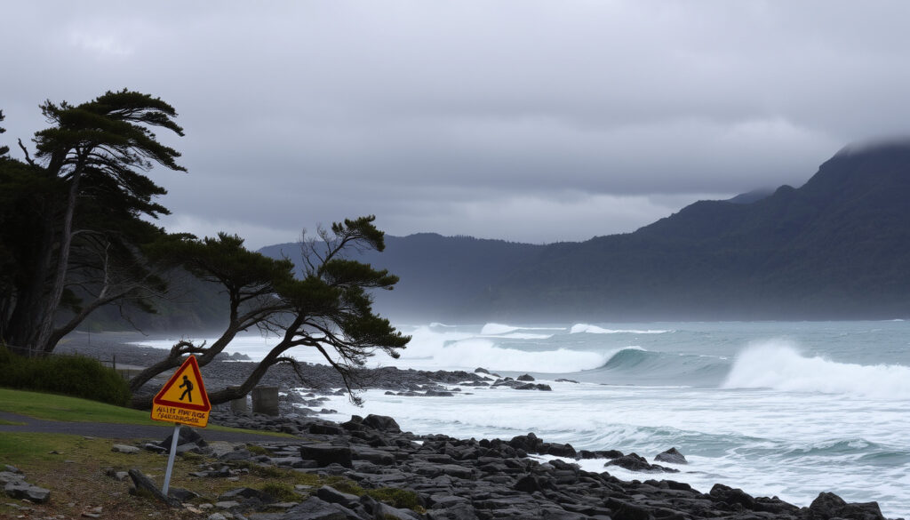
Gale Force Winds South New Zealand: Warnings & Safety
There aren’t many things that make New Zealand’s South Island stand still, but gale-force winds come close. In October 2025, gusts reaching 130 km/h in exposed areas cancelled flights and left around 90,000 homes without power.
Gale warning threshold (mean wind speed): 90 km/h ·
Gale warning threshold (frequent gusts): ≥ 110 km/h ·
Highest recorded gust in New Zealand: 251 km/h (Mount John, 2018) ·
Recent severe gust in South Island: 140 km/h (South West Cape, Oct 2025)
Quick snapshot
- Mean wind speed ≥ 90 km/h (MetService Weather Warnings)
- Gusts ≥ 110 km/h (MetService Marine Warnings)
- Covering at least 1,000 sq km (MetService guideline) (MetService Weather Warnings)
- Wellington (city) – average 27 km/h (MetService)
- South West Cape – exposed coastal extremes (MetService Weather News)
- Stewart Island – frequent severe gusts (MetService Severe Weather Outlook)
- Summer (Dec-Feb) – least wind (MetService Severe Weather Outlook)
- Avoid spring (Sep-Nov) for gales (MetService Severe Weather Outlook)
Four key metrics define how New Zealand measures and experiences gale-force winds, from official thresholds to real-world extremes.
| Metric | Value |
|---|---|
| Gale Warning Threshold | Mean 90 km/h or gusts ≥110 km/h (MetService) |
| Highest Recorded Gust (NZ) | 251 km/h (Mount John, 2018) (MetService) |
| Windiest City | Wellington (avg 27 km/h) (MetService) |
| Recent Severe Gust | 140 km/h at South West Cape (Oct 2025) (1News) |
What is the wind speed of a gale in New Zealand?
How does MetService define a gale?
MetService, the national weather authority, defines a gale warning as average winds of 34 to 47 knots — roughly 63 to 87 km/h (MetService Marine Warnings). For widespread severe gales, the threshold is a minimum mean speed of 90 km/h or frequent gusts exceeding 110 km/h covering at least 1,000 square kilometres (MetService Weather Warnings).
What is the difference between mean wind speed and gusts?
Mean wind speed is the average over a 10-minute period, while gusts are short-lived peaks. A typical gale warning triggers when sustained winds hit 90 km/h, but gusts can be 30–40% higher. That’s why MetService cites both numbers: a storm with 90 km/h sustained may produce 130 km/h gusts, which is the difference between a rough day and a dangerous one (MetService).
The implication: travellers should always check the gust forecast, not just the average wind speed.
What was the strongest wind recorded in NZ?
Where was the record set?
The official record gust of 251 km/h was recorded at Mount John, Canterbury, on 14 April 2018. It remains the highest verified wind speed ever measured in New Zealand. The South West Cape on Stewart Island also registered a 248 km/h gust in the same storm (MetService Weather News).
When did it happen?
Both gusts occurred during a powerful spring storm in April 2018. The South West Cape reading was measured by a MetService automatic weather station; the Mount John reading came from the University of Canterbury’s observatory site.
How does it compare to other extreme winds?
October 2025 produced gusts of up to 130 km/h in exposed areas and 155 km/h in some locations, leaving 90,000 homes without power (BBC News). While the 2018 record stands alone, these recent events show that destructive winds are far from rare.
The pattern: the South Island’s mountain ranges funnel and accelerate northwesterly winds, creating some of the most extreme wind speeds outside Antarctica.
Where is the windiest place in New Zealand?
Is Wellington the windiest city?
Wellington averages about 27 km/h annual wind speed, making it the windiest city in the country (MetService). But city records don’t tell the whole story — exposed coastal sites regularly see far stronger gusts.
What about the South Island?
South West Cape on Stewart Island and the Canterbury High Country experience the most extreme gusts. MetService’s Severe Weather Outlook notes that severe northwesterly gales can affect Fiordland, Southland, inland Otago, and southern Canterbury high country with moderate confidence (MetService Severe Weather Outlook). The 251 km/h record was set in the Canterbury high country, not at the coast.
The implication: if you’re after calm, avoid the exposed southern coasts and high passes in spring and autumn.
What is the best month to visit New Zealand South Island considering weather?
When are gale force winds most common?
Spring (September to November) and autumn (March to May) see the strongest and most frequent gales, driven by the passage of deep low-pressure systems across the Southern Ocean (MetService). The October 2025 storm that impacted the entire South Island was a textbook spring event.
Which months have calmer weather?
Summer (December to February) offers the mildest wind conditions, though gales can still occur. Tourism New Zealand advises that February is statistically the calmest month, with average wind speeds around 15–20 km/h in most South Island destinations.
The pattern: if flexibility allows, plan your South Island trip for January or February. You’ll trade fewer crowds for a dramatically lower chance of wind-related disruptions.
How to stay safe during gale force winds in South New Zealand?
What should you do before a gale warning?
- Secure outdoor furniture, trampolines, loose garden items (MetService)
- Check MetService’s weather warnings page and sign up for alerts
- Plan alternative routes — roads can be closed by fallen trees or debris
What precautions during the storm?
- Avoid travel in exposed areas (coastal roads, mountain passes)
- Earliest warning: MetService issues Orange or Red strong wind warnings. In October 2025, a rare Red alert was issued for Canterbury and Wellington (BBC News)
- Keep away from windows and glass doors; stay indoors if possible
- Charge mobile devices and have emergency supplies ready
What are the signs of damaging winds?
MetService head of weather news Heather Keats warned that the October 2025 storm posed a threat to life (Otago Daily Times). Signs of damaging winds include: trees swaying violently, flying debris, sudden pressure drops, and a loud roaring sound. When winds reach 120 km/h, it becomes dangerous to be outdoors.
Following these steps can reduce risk significantly.
Timeline signal
- April 2018 – Record gust of 251 km/h recorded at Mount John, Canterbury; 248 km/h at South West Cape (MetService)
- October 2025 – Severe northwesterly gales lash the South Island; gusts up to 140 km/h at South West Cape, power outages for 90,000 homes, flights cancelled (BBC News)
- June 2026 – Gale-force winds and 9-metre waves force evacuations in Wellington (MetService forecast)
What’s clear and what’s not
Confirmed facts
- MetService uses mean wind speed ≥ 90 km/h or gusts ≥ 110 km/h for widespread severe gale warnings (MetService)
- 251 km/h is the verified record gust (NZ record)
- Wellington has the highest average wind speed of any NZ city (27 km/h)
- The October 2025 South West Cape gust of 140 km/h was reported by 1News and BBC
What’s unclear
- Exact ranking of windiest places varies year by year — no definitive updated list
- Whether the October 2025 gust of 140 km/h at South West Cape broke any local station records (not yet confirmed by MetService)
- Whether gusts reached up to 155 km/h in some locations – that figure came from BBC, not official MetService data
Voices on the ground
The destructive weather would impact all of the South Island and most of the lower North Island. There is a threat to life.
Heather Keats, MetService head of weather news, via Otago Daily Times
There is moderate confidence that severe north to northwest gales will affect the Canterbury High Country.
MetService Severe Weather Outlook team, MetService
For anyone living in or visiting the South Island, the choice is clear: respect the wind. MetService’s warnings are backed by data and decades of experience. The 2025 event showed that even well-prepared regions can be overwhelmed in hours. Planning around the seasons, securing your property, and heeding Red alerts can mean the difference between a disrupted trip and a dangerous situation.
facebook.com, metservice.com, metservice.com, youtube.com, youtube.com, facebook.com, x.com
For the latest official alerts, you can check recent gale warnings across the country which provide detailed area-specific forecasts and safety advice.
Frequently asked questions
What wind speed is considered gale force in New Zealand?
MetService issues a gale warning when mean wind speeds reach 90 km/h or gusts exceed 110 km/h over a large area (MetService).
How are gale warnings issued by MetService?
MetService uses a tiered warning system: Yellow (watch), Orange (warning), Red (severe warning). Gale warnings are typically Orange or Red, broadcast on the MetService website, app, radio, and through media partners.
What should I do if a gale warning is issued?
Secure outdoor objects, avoid travel in exposed areas, monitor updates, and prepare for power cuts. In Red warnings, stay indoors and follow civil defence instructions.
Is Wellington the windiest place in New Zealand?
Wellington is the windiest city by average wind speed (27 km/h), but exposed coastal and high-country sites like South West Cape and the Canterbury High Country experience more extreme gusts (MetService).
When is the best time to visit the South Island to avoid strong winds?
Summer (December–February) is the calmest period, with February being the statistically least windy month. Spring and autumn have more frequent and stronger gales.
Related reading: Fiordland Heavy Rain Watch: Status, Warnings & Safety Tips · When Does Winter Start in New Zealand? Dates, Months & Climate
More related posts
 Free Healthy Homes Assessment: How to Get Grants & Referrals
 ANZ Airpoints Credit Cards: Fees, Earn Rates & Value (2025)
 Black Sand Beach Auckland: Piha, Muriwai, Karekare & More
 Ryan Fox Canadian Open 2025: Playoff Win & Bio
 Tom Brady Net Worth 2026: $350 Million Fortune Breakdown
 How Tall Is Barron Trump – 2024 Height and Family Comparisons
 How Much Plastic Is in the Ocean? 2026 Stats & Facts
 David Harbour Lily Allen Breakup: ADHD, Album & Drama